The Air Defense Identification Map
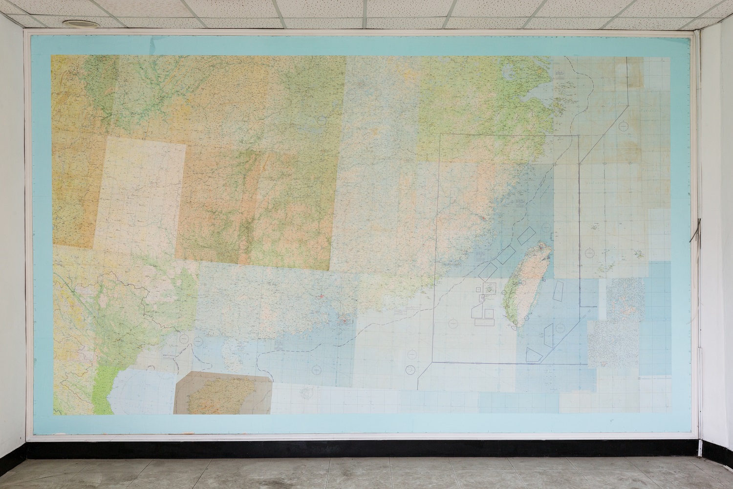
This is a map mounted on the wall on the second floor of the oldest building in the Air Force Command Headquarters, the former Governor-General’s Industrial Research Institute as a remnant after the Air Force Command Headquarters was relocated in 2013. The map is the navigation route map of the Taiwan flight areas dedicated to fighter pilots. It is superscripted by the Taiwan Province Air Defense Identification Zone. The square frames and the round frames of the island are all target areas. The four box target areas in the South China Sea have changed due to changes in time and space, so they are no longer used. At that time, all the fighter pilots were all armed with a flight map which they placed in their leg pockets and this map was originally classified as secret.Photo by LU Guo-Way
DATE2019.12.24